All original images (C) Steve Douglass unless otherwise noted.

All original images (C) Steve Douglass unless otherwise noted. Permission required for commercial use or publishing.

ABC7's Live Scanner Feed!

>

Monday, April 2, 2012

East Texas Panhandle/ Western Oklahoma - Tornado Watch pending


A TORNADO WATCH WILL LIKELY BE NEEDED FOR PORTIONS OF NWRN TX...THE
ERN OK/TX PANHANDLES...SWRN KS AND WRN OK THIS AFTERNOON AND
EVENING.

MID-AFTERNOON MESOANALYSIS SHOWS A COLD FRONT WAS LOCATED FROM SWRN
KS INTO ERN NM...WHICH IS BEGINNING TO STALL IN RESPONSE TO PRESSURE
FALLS AHEAD OF A POTENT NEGATIVELY TILT MIDLEVEL SHORTWAVE TROUGH. A
DRYLINE ACCOMPANIED BY DEEPENING CUMULUS EXTENDED SWD FROM THE KS
PORTION OF THE COLD FRONT...WHILE A PACIFIC FRONT WAS BEGINNING TO
ENTER W TX. SURFACE TEMPERATURES ALONG THE DRYLINE HAVE WARMED INTO
THE MID 80S...AND DEWPOINTS E OF THE BOUNDARY RESIDE IN THE UPR 50S
TO MID 60S. THE WARM/MOIST AIRMASS LOCATED ACROSS THE WARM SECTOR
COMBINED WITH STEEP MIDLEVEL LAPSE RATES /IN EXCESS OF 8 C PER KM IN
THE 700-500 MB LAYER/ ARE CONTRIBUTING TO A VERY UNSTABLE
ENVIRONMENT...WITH MLCAPE VALUES NEAR 3000 J/KG.

AS THE UPPER DISTURBANCE LIFTS NWD ACROSS THE SRN HIGH PLAINS THIS
AFTERNOON AND EVENING...SHORT-TERM MODEL GUIDANCE INDICATES SURFACE
CYCLOGENESIS WILL RAPIDLY TAKE PLACE OVER NERN NM AND THE TX
PANHANDLE. STRONG LOW-LEVEL SWLY WINDS OVER W TX...POSSIBLY
ACCOMPANYING AN EWD SURGE OF THE PACIFIC FRONT...WILL QUICKLY SPREAD
EWD TOWARD THE DRYLINE...RESULTING IN STRENGTHENING LOW-LEVEL
CONVERGENCE. AS THIS TAKES PLACE...SCATTERED THUNDERSTORM ARE
FORECAST TO DEVELOP FROM THE KS TRIPLE POINT SWD ALONG THE DRYLINE
BY 22-00Z.

DURING THE EARLY STAGES OF THIS CONVECTIVE EPISODE
TEMPERATURE-DEWPOINT SPREADS WILL BE NEAR 20F OVER THE WARM
SECTOR...AND MIDLEVEL FLOW/DEEP LAYER SHEAR WILL BE MARGINAL FOR
SUPERCELLS...WHICH MAY NEGATIVELY INFLUENCE THE POTENTIAL FOR
TORNADOES DUE TO EXCESSIVE OUTFLOW. HOWEVER...IF STORMS CAN REMAIN
QUASI-DISCRETE INTO THE EVENING...THEN A COOLER/MORE HUMID BOUNDARY
LAYER COUPLED WITH BACKING/STRENGTHENING 0-1 KM FLOW MAY LEAD TO A
MORE SUBSTANTIAL THREAT OF TORNADOES. OTHERWISE...STORMS WILL POSE A
THREAT FOR VERY LARGE HAIL GIVEN THE PRESENCE OF LARGE BUOYANCY AND
VERY STEEP LAPSE RATES...IN ADDITION TO LOCALLY DAMAGING WIND GUSTS.

Wednesday, March 21, 2012

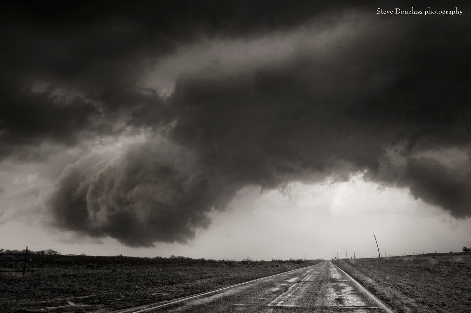
Driving underneath the tigers' paw


(C) Steve Douglass

Tuesday, March 20, 2012

Skyway Highway


(C) Steve Douglass

Oklahoma tornadoes and structure videos: March, 18, 2012


Video by Wesley Luginbyhl


Video by Bart Comstock


Video by Storm Chase Media

Monday, March 19, 2012

Tornadoes in SW Oklahoma 3-18-2012


The 2012 severe weather season took off with a roar yesterday as several supercells spawned numerous tornadoes in SW Oklahoma yesterday. Here are a couple pix. I'll post more later including video. It was an amazing chase.

-Steve Douglass

RELATED STORY: OKLAHOMA CITY (AP) — Several possible tornadoes damaged electrical power lines but caused no injuries when they touched down in western Oklahoma on Sunday, authorities said.

Tornado warnings were issued for sparsely populated areas of Beckham, Greer and Washita counties just before sunset.

Beckham County Emergency Management Director Lonnie Risenhoover said crews were still surveying the area, but no injuries or damage had immediately been reported.

"I actually saw the tornado in the Spring Creek area near Carter, and it looked pretty large," but touched down in a rural area, Risenhoover said. Another possible tornado was spotted near Retrop in the southeastern part of the county.

In Greer County, emergency management director Glynadee Edwards said a possible tornado damaged power lines near Willow, but officials hadn't received reports of injuries or additional damage. A tornado warning was issued for Washita County, but the sheriff's office hadn't received reports of injuries or damage.

Thursday marked the beginning of the spring tornado season in Oklahoma, so Sunday's storm aren't unusual, National Weather Service forecaster Daryl Williams said.

"We have this upper-level disturbance creating a lot of instability in the atmosphere and we had a least a few short-lived and small tornadoes develop," Williams said.

A tornado watch for 14 counties in western Oklahoma was allowed to expire as the tornado threat appears to have diminished, Williams said.

A flash flood watch for eastern Oklahoma remained in effect for another anticipated round of severe storms, which Williams said may not have as a strong of a tornado threat as those on Sunday.

The weather service said 4 to 8 inches of rain could be widespread and isolated totals approaching 12 to 15 inches were possible in flash flood watch areas, which could lead to catastrophic flooding.

Copyright 2012 The Associated Press.

Saturday, March 17, 2012

Friday, March 16, 2012

First Storm Time Lapse of 2012

(C) Steve Douglasss

Wednesday, February 29, 2012

Amarillo dust storm from the air ...


Photograph by Stephen Bilodeau NWS Amarillo, from a SW airlines flight over the Texas Panhandle.

Tuesday, February 28, 2012

Another duster - another sunset.


Yes, the wind and the dust are a pain. It gets in everything, your eyes, ears, you can feel the grit on your teeth - but at the end of the day - when the sun that set the winds in motion sets- the Panhandle Skies are oh so pretty.

(C) Steve Douglass

Sunday, January 29, 2012

Sunday, January 22, 2012

Echoes of the Dust Bowl ...


Another duster rolled through Amarillo today - with 70 mph winds that toppled semis, pushed wildfires, snapped power lines, caused multi-car pileups due to zero visibility and tore at roofs. Once the front passed - the dust was put down by a decent rain. This photo was taken at I-40 & Soncy - because it looked like something straight out of the Dust Bowl.

-Steve Douglass

Sunday, January 1, 2012

2012 is here!

Sunday, December 25, 2011

Blue Christmas


(C) Steve Douglass

Amarillo's white Christmas!

I was pleasantly surprised to wake to a lovely blanket of snow covering the ground this Christmas morning. What a lovely gift for a photographer!

After church - I took a solitary walk through John Stiff park to celebrate Christmas - and take a few photos. It was a wonderfully gorgeous stroll.

Enjoy!

-Steve Douglass

webbfeatproductions.com


I was pleasantly surprised to wake to a lovely blanket of snow covering the ground this Christmas morning. What a lovely gift for a photographer!

After church - I took a solitary walk through John Stiff park to celebrate Christmas - and take a few photos. It was a wonderfully gorgeous stroll.

Enjoy!

-Steve Douglass
webbfeatproductions.com

Tuesday, November 8, 2011

Monday, November 7, 2011

Saturday, November 5, 2011

Dusty Dusk ....

Sunday, October 30, 2011

October on the lake ...


Photographed today at Lake Meredith. (C) Steve Douglass

Saturday, October 29, 2011

Pirates Of The Canyon - Balloon Glow 2011 video


(C) Steve Douglass

Sliver Birds


(C) Steve Douglass
Any reproduction with permission is prohibited

Click to enlarge!

Please click on each image to enlarge them and see them in their proper color and contrast.