All original images (C) Steve Douglass unless otherwise noted.
All original images (C) Steve Douglass unless otherwise noted. Permission required for commercial use or publishing.
ABC7's Live Scanner Feed!
>
Sunday, May 31, 2009
Possible chase day Tuesday.
..CNTRL/SRN PLAINS...
BOUNDARY LAYER DEWPOINTS IN THE 50S TO LOWER 60S WILL COINCIDE WITH
EML/STEEP LAPSE RATE PLUME WITH A MODERATELY UNSTABLE AIR MASS
DEVELOPING BY AFTERNOON AHEAD OF COLD FRONT. THE COMBINATION OF
FRONTAL ASCENT AND DEEP-LAYER FORCING ASSOCIATED WITH SLOW-MOVING
VORTICITY MAXIMUM MOVING ACROSS THE REGION SHOULD FOSTER SCATTERED
TO NUMEROUS TSTMS ALONG BOUNDARY THROUGH THE AFTERNOON AND EVENING
HOURS. WHILE ENVIRONMENT WILL REMAIN ONLY MARGINALLY SHEARED...THE
STRONGER STORMS WILL BE CAPABLE OF DAMAGING WINDS AND HAIL GIVEN THE
PRESENCE OF THE STEEP LAPSE RATES AND ANTICIPATED EVOLUTION TO LINE
SEGMENTS OR A LINEAR CONVECTIVE SYSTEM.
Monday, May 25, 2009
Severe No - Pretty Yes
We had a storm system (cold front) sweep through the Texas Panhandle today. At sunset we had some amazing technicolor clouds off the the east and then when the cold front swept through we had a good lightning storm sweep through the city
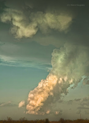
This first shot was made north of Amarillo looking toward some cauliflower storms to our NE.
Shot with a Nikon D-70s/300 mm zoom and a 2X converter to compress the foreground house and trees and the storm in the background.
Here's anquite accidental and strange shot I took when the storm moved into Amarillo . I was trying to shoot some lightning (using a 30 sec exposure) but forgot to turn of my flash. When the flash fired it froze the raindrops and then a big flash of lightning streaked in the sky behind the rain.
It made for an interesting image.
Canon Pro-1
Here's another frozen rain photograph but this time I purposely set my flash up to try and capture the falling drops.
I set the focus about one foot in front of the lens.
.
Saturday, May 23, 2009
Popcorn Storms
Beautiful, but non severe, these "popcorn storms" keep popping up and dying down all over the Texas Panhandle. On average they last 45 minutes to an hour, drop a little rain, maybe some small hail and then die. Here are a couple in the building stages before they were whisked away by the Monsoonal winds.
-Steve Douglass
Friday, May 22, 2009
Electrifying!
We may not have any storms, but apparently someone has had some doozies!
This storm pictures was taken yesterday morning in Cape Town, South Africa.
It was sent to me by Linda Vanreenan. She lives here in Amarillo, but has friends and family in Cape Town and knows my passion for lightning photos.
Thanks Linda!
This storm pictures was taken yesterday morning in Cape Town, South Africa.
It was sent to me by Linda Vanreenan. She lives here in Amarillo, but has friends and family in Cape Town and knows my passion for lightning photos.
Thanks Linda!
Nothing severe but maybe photogenic storms?
DAY 1 CONVECTIVE OUTLOOK
NWS STORM PREDICTION CENTER NORMAN OK
0219 PM CDT FRI MAY 22 2009
VALID 222000Z - 231200Z
...NO SVR TSTM AREAS FORECAST...
HAVE GREATLY EXPANDED THUNDER POTENTIAL ACROSS MUCH OF TX BASED ON
WWD MOISTURE SURGE AND DEEPENING CONVECTION OVER PORTIONS OF THE
HILL COUNTRY. ADDITIONALLY...ISOLATED THUNDERSTORMS HAVE EVOLVED
ACROSS PARTS OF OK AND THIS AREA WILL BE ADDED TO THUNDER AS WELL.
FARTHER NORTH ACROSS THE UPPER MS VALLEY...WELL DEFINED UPPER
VORT/SHORTWAVE TROUGH IS SHEARING EAST ACROSS MANITOBA INTO NWRN
ONTARIO. THUNDERSTORMS ARE DEVELOPING SWWD ALONG TRAILING COLD
FRONT INTO NWRN MN/NERN ND AND THIS ACTIVITY SHOULD SPREAD ACROSS
NRN MN INTO THE EVENING HOURS. MOST CONCENTRATED ACTIVITY IS
EXPECTED TO REMAIN NORTH OF THE BORDER WHERE LARGE SCALE FORCING IS
GREATER.
OTHERWISE...STRONG THUNDERSTORMS SHOULD DEVELOP OVER PARTS OF ERN WY
LATER THIS AFTERNOON AS LOW LEVEL LAPSE RATES CONTINUE TO STEEPEN
ALONG FAVORED ZONE OF CONVERGENCE.
..DARROW.. 05/22/2009
.PREV DISCUSSION... /ISSUED 1114 AM CDT FRI MAY 22 2009/
ANOTHER QUIET CONVECTIVE DAY IS EXPECTED TODAY ACROSS MUCH OF THE
UNITED STATES AS STRONG WESTERLIES ARE CONFINED TO THE NORTHERN TIER
OF STATES...AND RICH LOW LEVEL MOISTURE ONLY RESIDES OVER THE
SOUTHEAST REGION. SCATTERED AFTERNOON THUNDERSTORMS ARE EXPECTED
OVER THE GULF COAST STATES IN ASSOCIATION WITH BROAD UPPER LOW OFF
IN THE CENTRAL GULF. HOWEVER...EXTENSIVE CLOUDS AND WEAK LAPSE
RATES WILL COMBINE WITH MARGINAL VERTICAL SHEAR TO SUPPRESS
ORGANIZED SEVERE STORMS.
...NEB/SD/WY...
WEAK EASTERLY/UPSLOPE LOW LEVEL FLOW IS FORECAST TO DEVELOP OVER
WESTERN NEB AND EASTERN WY THIS AFTERNOON. THIS WILL HELP TO
TRANSPORT SLIGHTLY MORE MOIST AND UNSTABLE AIRMASS INTO HIGHER
TERRAIN OF EASTERN WY...WHERE CONCENSUS OF MESOSCALE AND OPERATIONAL
MODELS DEVELOP SCATTERED STORMS. THESE STORMS MAY DEVELOP EASTWARD
INTO WESTERN NEB DURING THE EVENING. WEAK FLOW ALOFT WILL RESULT IN
SLOW MOVING MULTICELL CLUSTERS CAPABLE OF SOME HAIL.
Wednesday, May 20, 2009
Saturday, May 16, 2009
Lurking in the storm a tornado.
This is a photo of a wall cloud in the Gray County storm. It was becoming rain-wrapped and near impossible to see if there was a tornado in it, although a tornado warning had been issued at this time. I took this photo not knowing I was indeed looking at a tornado.
(C) Steve Douglass
This is the same shot processed in Photoshop, and by playing with the values, curves, contrast and brightness controls the tornado is revealed. NWS says this storm spawned five tornadoes.
(C) Steve Douglass
Here's another frame enhanced and color corrected.
NWS report on this storm HERE.
In the grip of the beast
Friday, May 15, 2009
Another Green Monster - this time near Pampa.
Thursday, May 14, 2009
Rant: Tornado Tourists Suck!
Me thinks there are too many stupid amateur storm chasing junkies who know just enough about storms to be dangerous.
Its getting so bad now that I have seen traffic jams caused by gawkers who will do anything to get close to a tornado, including those dumb enough to pay good money to go on a "tornado tours" with yahoos who follow the Vortex trucks.
Mark my words, one of these van-loads of tornado tourists is going to get rolled and these idiots will become front page news or in their haste to get away (because they were stupid enough to get themselves trapped between a softball-sized hail core and a twister) they will cause others to die in a fiery head-on collision.
I hesitate to post a link to this video, because:
A: It's not very good.
B: Only encourages the yahoos but - what you see here is an example of what NOT to do.
Unfortunately, someone is going to die and their demise will be caught on High-Def video (and then widely distributed by the media or on YouTube ) for your entertainment pleasure.
I've been a NWS certified storm spotter for over 15 years and I have never seen it this bad.
Author's note: Shortly after I posted this, a relative of mine thought (for some unknown reason) this rant was a reference to her. She occasionally goes out with her husband and photographs storms and took offense to my post.
I want to sing "You're So Vain" but the truth is this rant was in response to the dozens of chasers I've encountered this season.
Wednesday, May 13, 2009
Subscribe to:
Posts (Atom)
Click to enlarge!
Please click on each image to enlarge them and see them in their proper color and contrast.